
A quick post to share a track that isn’t yet on the OS map…
A work appointment in Dunoon this morning led to a 200mi round trip for a couple of hours of work, so the only sensible thing to do was take a half day and pack the FF29. Beinn Bhuidhe is the only munro in the “Arrochar Alps” area I have not yet climbed, but a look at the forecast convinced me that ticking off the summit today (on my own and in driving rain) would probably not be a sensible idea.
Instead, I decided to stick to the main track built for a recently constructed hydro scheme, and get some much needed riding in the legs, scoping out the route for a ride next time I have a work commitment down this way. This looks like a munro where the top section will be a steep walk, but I planned to just ride up and down the track this time round (and didn’t even bother packing the walking boots).
The track is pretty much as you would expect for hill tracks made for these kind of schemes – rough and steep. A couple of short pitches (about 70m of climbing at 450m) required walking, but the rest could be grunted up in a granny gear. Definitely not as rideable as the local climb up Ben Chonzie, but a lot quicker to get up (and down!) than walking the whole route in from the road. For going on to the summit, the usual walking path apparently crosses this track a bit before the point where I turned round, but I must have missed it when trying to keep my head down out of the rain. The track down over the side of Newton Hill is steeper, but works okay as a descent, and allows for a bit of variety on the return leg.
Given that the track is not yet plotted by Ordnance Survey, I have posted the GPX file for use when planning your own route.
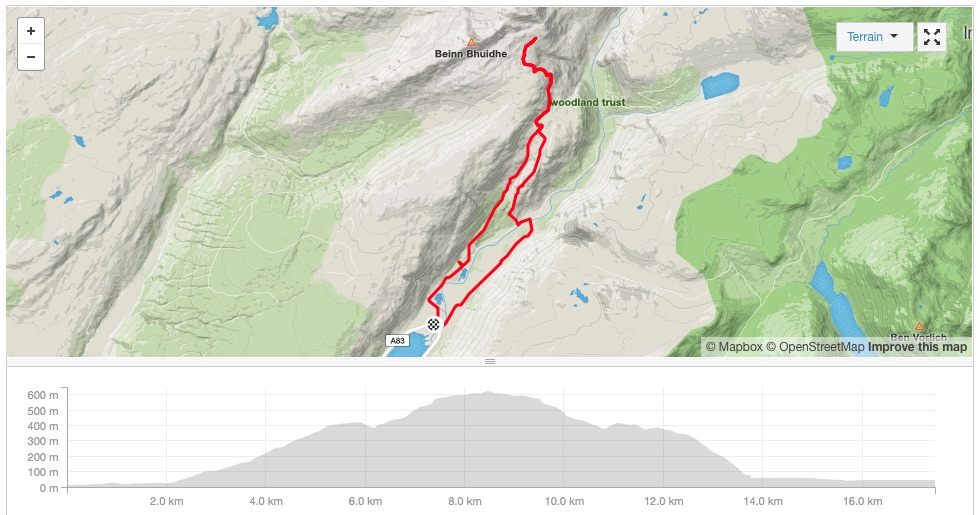
Beinn Bhuidhe Hydro Track Map