
The next leg of my ride on the Scottish National Trail has been a long time coming. The last day on the trail was back in April of this year, but a dry September and a free weekend finally coincided to get a few more miles under the tyres.
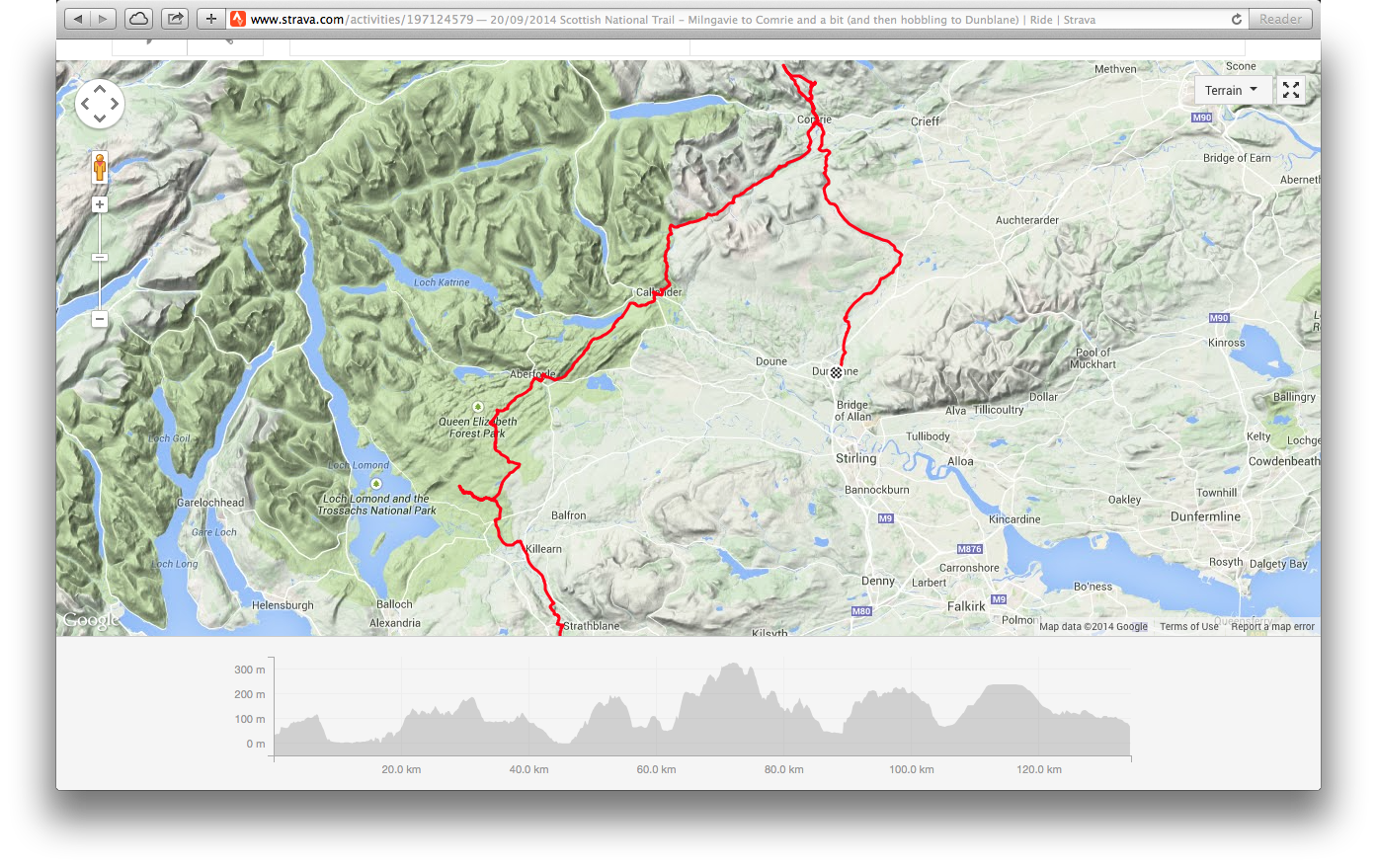
I plotted out the route some time ago with the next leg being Milngavie to Comrie, followed by a separate, slightly shorter day for Comrie to Pitlochry. With a lack of train lines in the Comrie area, the obvious solution is an overnight there, but a full calendar put pay to that plan, so I found myself on the 4.50am sleeper from Edinburgh to Westerton, and pedalling up to Milngavie for a 6am start with the intention of reaching Pitlochry in the evening. Combining the two sections would give a total length of around 90 miles.
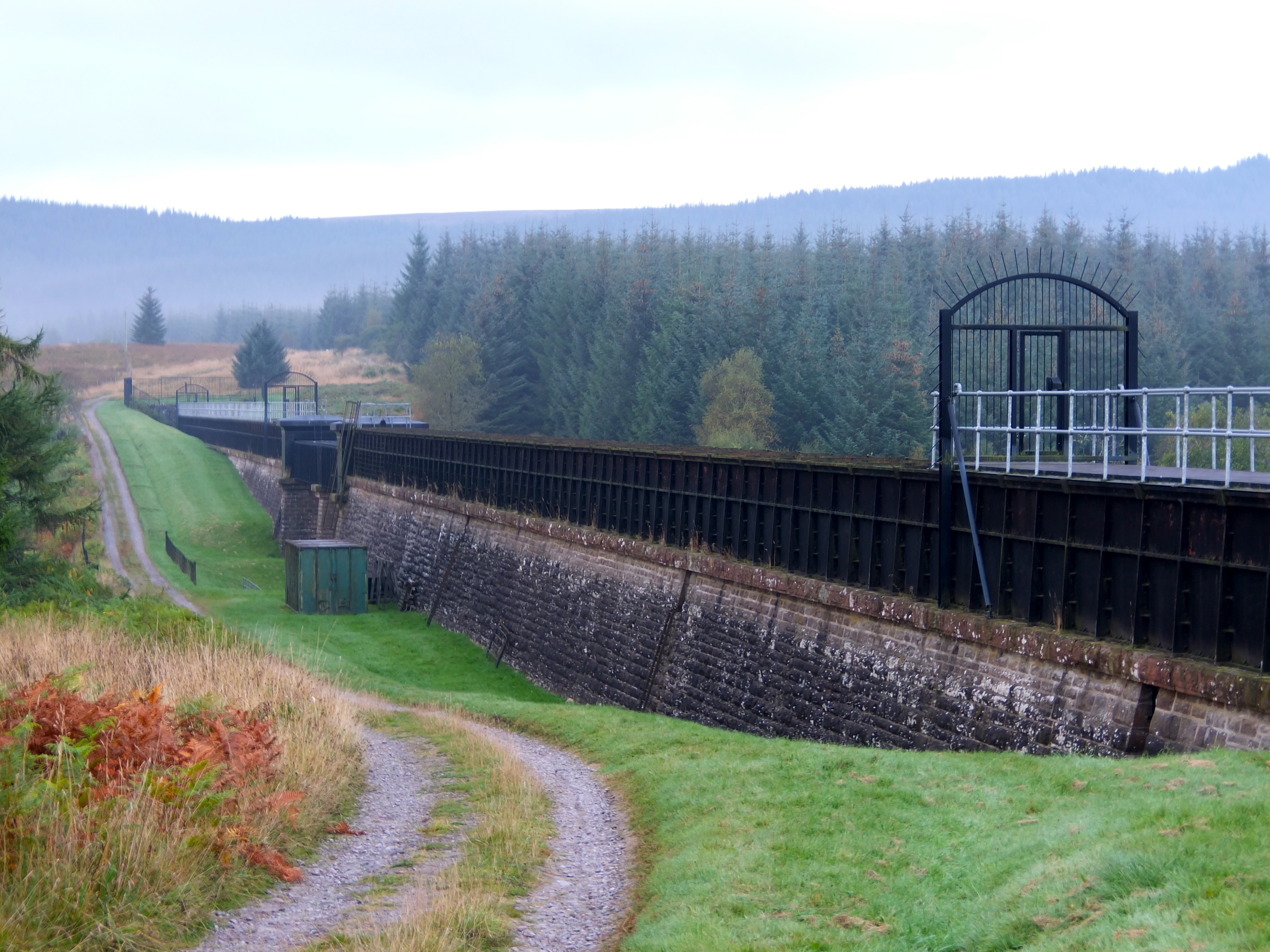
The initial riding from Milngavie northwards will be familiar to many Scottish mountain bikers – the easy, fast start section of the West Highland Way (interspersed with those bloody gates). My speed was kept in check by the pre-dawn light, but the miles were ticked off and Drymen approached. A lapse in concentration saw me continue on the West Highland Way for a couple of miles more than necessary until I realised that Conic Hill was alarming close, and re-traced my steps to pick up the Rob Roy Way. The riding here was similarly easy – fast forest fire tracks and roads into Aberfoyle, bypassing the Victorian industrial heritage of Glasgow’s water supply.
-
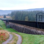
- Victorian drinking water anyone?
-
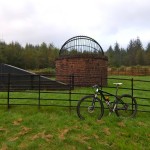
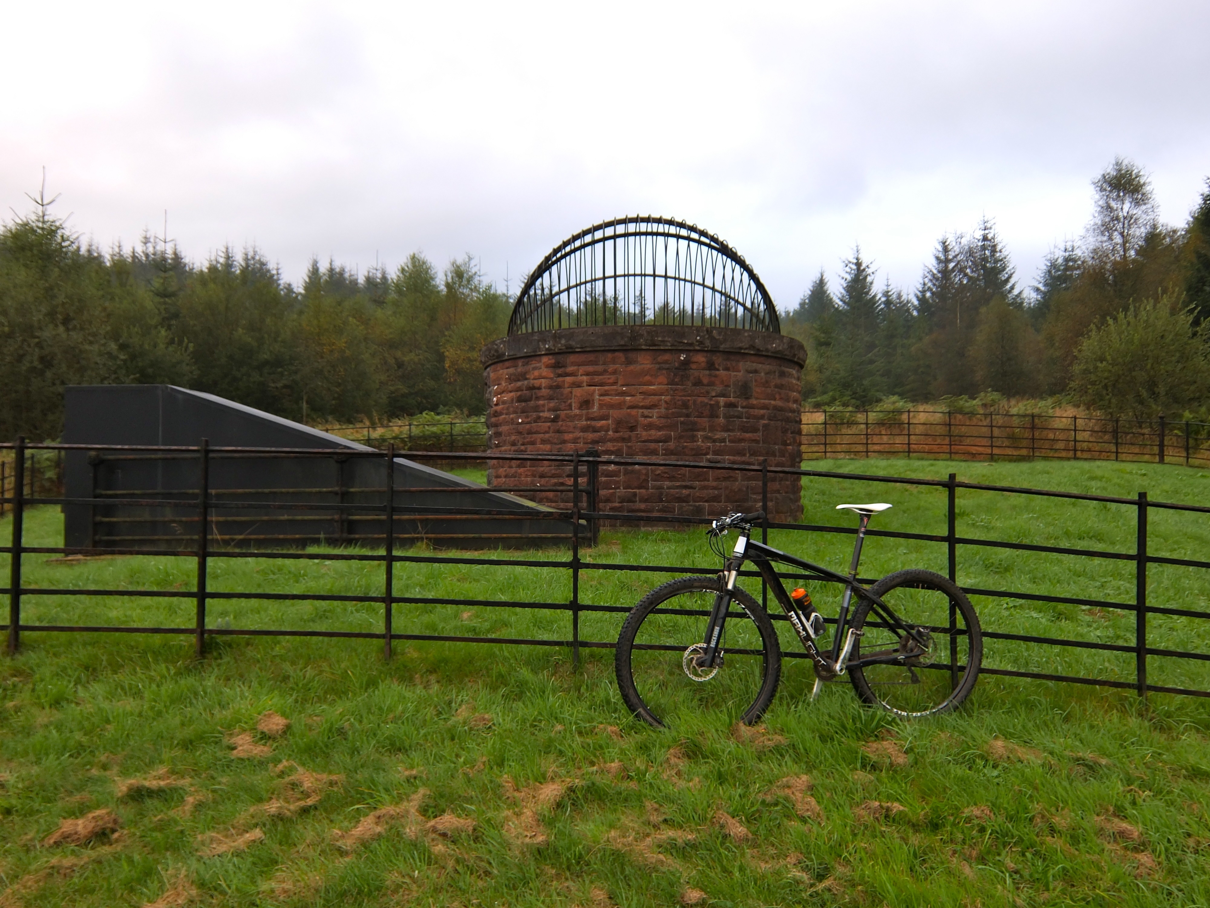
- Quenching Glasgow’s thirst
-
- Hanging around above Loch Venachar
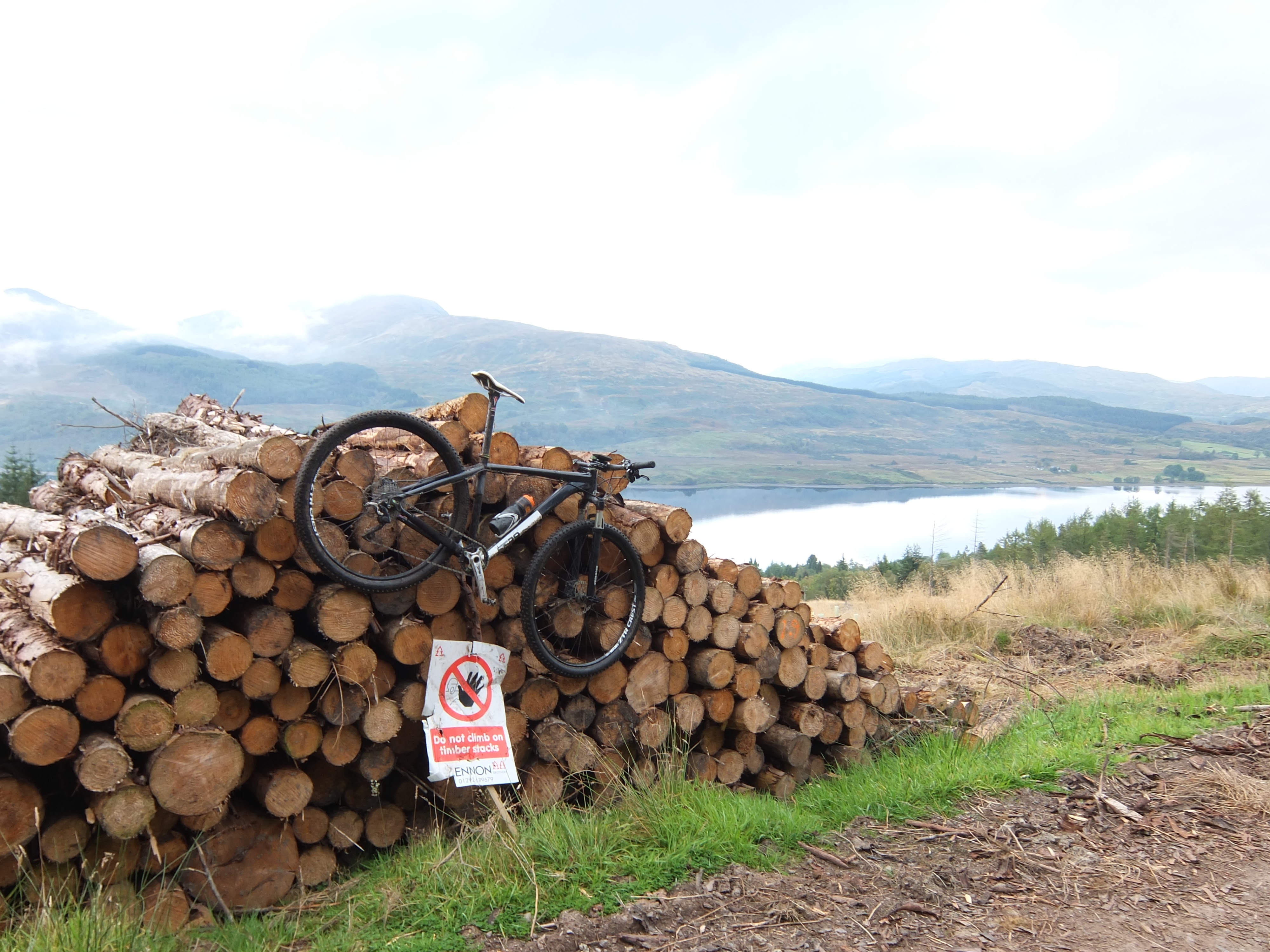
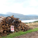
The route from Aberfoyle started by Dounans Centre, bringing back memories of many a Scottish XC race (thankfully no need for 4 laps up Heart Attack Hill today). Today’s path climbed more gradually eastwards, petering out to single track interspersed with a series of rocky step ups that wouldn’t have been out of place in a manmade trail centre. Mostly rideable with fresh legs on a good dry day, this was a dry day, but I was already 25 miles in by this stage. Remounting was followed by an over the bars in an invisible hole in the grass, but it was good to be riding a good mountain bikers’ trail. The singletrack spat me out on to familiar forest trails by Loch Venachar, and the run into Callendar was broken up by a short detour into the woodland trails at Coilhallan – not technical, but a welcome alternative to the obvious road link.
After a first lunch in Callander (at 9.30am?!) I bumped into some friendly company in the form of another rider for a slog up by Bracklinn Falls and on to a good track towards the south side of Ben Vorlich. The bridge shown on the OS map by Arivurichardich has long since disappeared, and even after a dry September, it was tricky crossing without getting wet feet. It turned out to be tricky to cross without getting a wet backside too, as a cleat to green rock interface ended with the inevitable sit down in the river. At least it gave me a chance to check whether my rear light would work underwater. It turns out that CatEye lights can withstand a full dunking: it fared better than my bruised coccyx.
The track eastwards was a well worn land rover track, giving two good single track grooves, livened up slightly by some overhanging bracken to catch out the unwary. For the first time on the Scottish National Trail, the views felt almost Highland – empty glens accessible only to the determined, backdropped by impressive slopes that only proper Scottish mountains can provide. At this point I pressed on solo, as my fellow rider, John, headed off towards Ben Vorlich for some hike-a-bike. Continuing on towards the top of the road by Auchinner, the suggested route eschews the good access road in favour of the track on the north side of the river. Only the most generous cartographer could describe this as a track though – the reality was a rough line of flattened marshy grass, lightly trodden by sheep. Anyone riding this on anything other than the driest summer’s day might prefer the easier option of the access road towards Comrie. Eventually the track does improve after passing a couple of bothys though, and the run into Comrie was easy enough.
By this time, I had been on the go for the best part of 6 hours, so a second lunch (at noon, so at least it was lunchtime this time) and a bit of recuperation in Comrie was in order. A calf niggle at the start of the ride 60 miles ago was making itself known. In hindsight, a tweaked muscle after a recent race had been ignored, and a new misaligned cleat was probably to blame. Despite adjusting that back in Callander, I wasn’t sure how much further I could push on for. I ordered a recovery coffee only to be told (in the friendliest way) that I looked a bit muddy. I lacked the energy for banter and the best I could manage was an apologetic explanation that I would be taking away rather than sitting in. At this point all I could think of was that this would be a great place to break the ride with an overnight in a hotel with the family, as had been the original plan.
After a caffeine boost, the climb out of Comrie through the “Deil’s Caldron” offered a nice piece of trail through the wood below the single track road. Turning off to cross the River Lednock, a short link on the route plan turned out to be a push through waist high bracken, before rejoining a better track following the east side of the river. Arriving at the car park at Invergeldie, I knew I was faced with a 25 mile relatively remote section towards Aberfeldy. With a calf muscle that was now making its presence known on every pedal stroke, I sat in the sun for a few minutes and made the difficult decision to abandon, heading back down the road to Comrie and onwards over the 20 miles to the nearest train station at Dunblane. Game over.
Doing an about turn at least allowed me to descend through the woods by the Deil’s Caldron again. Even that didn’t got quite to plan though, as I rounded an almost blind bend at speed to be confronted with a narrow bridge over a burn. Realising that I wasn’t going to make the bridge, and that falling off the side of it would result in certain death (well, possibly), I made the quick decision to hammer on the anchors and ditch the bike – face brake fully deployed. After picking myself up and dusting down the bike, I realised that there was a rideable line through the burn beside the bridge. Idiot.
As I hobbled back on the road (freewheeling the downhills, riding one legged on the flats and standing up on the climbs to stretch that dodgy calf muscle out better) I knew I had made the right decision. It was frustrating to abandon a ride, knowing that my legs were otherwise fit enough to make the 90mi to Pitlochry, (that would still have been shorter than last year’s South Downs Way), but I was heartened by the thought that I would enjoy the next section soon as a shorter 40 mile day out with fresh legs.
Scores on the doors:
Total miles: 134.5km from Milngavie to Dunblane (of which about 100km was on the SNT – the rest being the road ride back to the Scotrail Recovery Service)
Rideability: 99.9%
Red squirrel count: 1
OTBs: 1
Face brake applications: 1
Dents added to the top tube: 1
Sit down protests during river crossings: 1
Visits from the puncture fairy: 2 (1 small tubeless hole which took two shorts stops to fully seal)
The planned GPX for Part 4 from Milngavie to Comrie can be found here.
The GPX for the ride (including a few short wrong turns, a forestry diversion and the escape to Dunblane can be found here.